
GTA 6 safehouse locations
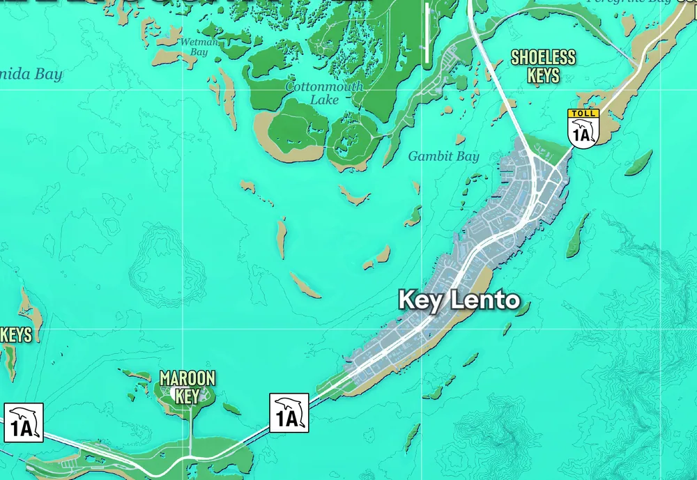
Your first home is Jason’s stilt house on Key Lento in the southern Leonida Keys. The Key Lento label is in square K6 on Rockstar’s printed map. For a precise route to the home available in your save, open Personal in the game’s map index and select the safehouse.
On this page
Find the first house
On the printed map, start at Key Lento in K6. Southwind and Mile Zero Air Station are farther southwest in L3. If either is the nearest label, follow the island chain northeast toward Key Lento. The printed grid gets you to the island. Use the home marker for the final turn.
Take the outside stairs up to the front door. The kitchen opens into the living room.
Gameplay by GTA Series VideosMark your current safehouse
- Open the mapPressPS5Touch padXboxView
- Open the IndexPressPS5D-pad →XboxD-pad →
- Set the selected home as the destinationPressPS5CrossXboxA
Safehouses by chapter · Show spoilers
You unlock these homes through the story. Each grid square marks the neighborhood on Rockstar’s poster. Use your in-game home marker to find the building.
| Chapter | Home | Neighborhood on the poster | Map |
|---|---|---|---|
| 1 | Jason’s house | Key Lento, K6 | View on mapHouse location |
| 2 | Starlet Motel | Port Gellhorn, E3 | View on mapTown reference |
| 3 | Bayside apartment | Bayside, G7 | View on mapDistrict reference |
| 4 | Ocean Beach home | Ocean Beach, G8–G9 | View on mapDistrict reference |
Homes and garages
The story unlocks homes. The real estate app lists purchasable garages for vehicle storage. If you need a bed, choose the safehouse entry in Personal. A garage marker can take you to a parking space without a bed.
Other places mentioned
| Place | Grid | Where to look | Map |
|---|---|---|---|
| Key Lento | K6 | On the island highway in the south of the state. | View on mapTown label |
| Leonida Keys | K6–L3 | The chain of islands between Key Lento and Southwind. The marker identifies the island chain. | View on mapRegion reference |
| Southwind | L3 | Southwestern end of the Keys, beside Mile Zero Air Station. | View on mapTown label |
| Mile Zero Air Station | L3 | Runways beside Southwind at the southwestern end of the island chain. | View on mapLandmark label |
| Port Gellhorn | E3 | The coast of Kelly County, west of Ambrosia. | View on mapCity label |
| Bayside | G7 | Waterfront neighborhood south of Stockyard. | View on mapDistrict label |
| Ocean Beach | G8–G9 | On the Atlantic side of Vice Beach, east of Starfish Island. | View on mapDistrict label |